Venezuela's Quake Alert Came From Phones, Not Seismometers
How Google turned billions of smartphone accelerometers into the world's largest earthquake early warning network.
Opening
Hello, dear reader. This is Oswarld’s Knowledge Talking. Yesterday evening (June 24), northern Venezuela was hit by back-to-back earthquakes of magnitude 7.1 and 7.5. It was the country’s strongest earthquake in 125 years. Buildings collapsed in the capital, Caracas, and a national state of emergency was declared.
But in the immediate aftermath, what went viral on X (formerly Twitter) wasn’t just photos of the collapsed buildings. It was screenshots of a warning notification on Android phone screens. “Magnitude 6.2 earthquake detected, about 341 km away” — and this alert reportedly arrived 3-5 seconds before the mainshock’s violent shaking did. One user posted “Google predicted the earthquake”; another wrote “my phone became a seismometer.” Here’s a fact worth pausing on: Venezuela has no dedicated seismic monitoring network. So how on earth did an alert go out in a country with no seismometers? To give you the conclusion up front: this is a technology story, but it’s also a story about the very model of building infrastructure being turned upside down.
🔔 The Screen-Rotation Sensor That Caught the P-wave
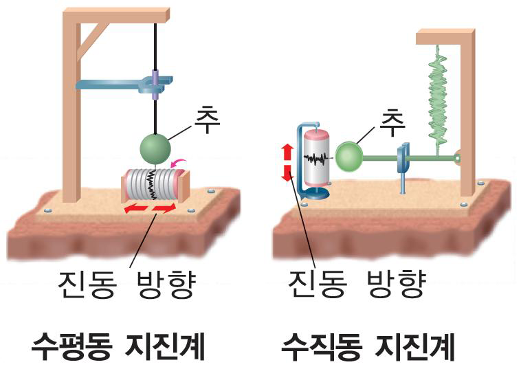
When an earthquake occurs, it generates two kinds of waves. First comes the fast but weak P-wave1, followed by the slower but far more powerful S-wave2. Most of the actual damage is done by the S-wave. Because the P-wave travels about 1.7 times faster than the S-wave, that time gap becomes the window for a warning.
Traditional earthquake early warning systems3 catch that P-wave with dedicated seismometers. The problem is the price. The US ShakeAlert system cost about $100 million (roughly ₩140 billion) to build, with annual maintenance alone running $39 million (about ₩54 billion). It required laying down 1,675 dedicated stations along the West Coast. Outside of Japan, South Korea, Taiwan, Mexico, and a handful of others, almost no country can afford investment at this scale. And the fact that most earthquake-prone countries are developing nations makes the problem even harder.
What Google zeroed in on was a sensor already sitting in pockets around the world: the accelerometer4** built into every smartphone — the very sensor that auto-rotates your screen when you turn the phone sideways — can, it turns out, also detect ground shaking. Its precision falls short of a dedicated seismometer, but when signals come in simultaneously from billions of phones, the story changes completely.**
Let me unpack how it works. When a stationary Android phone detects P-wave vibrations, it sends a signal to Google’s servers along with its approximate location. The servers then check whether similar signals are arriving simultaneously from multiple phones in the same area. The key phrase is ‘multiple phones.’ You can’t declare an earthquake just because one phone shook — it might have been dropped from a pocket, or picked up vibrations from a construction site next door. Only when dozens to hundreds of phones in the same area report the same vibration pattern at the same time does the system conclude, “this is a real earthquake.”
Once that call is made, alerts go out to users in areas the S-wave hasn’t reached yet. The alerts come in two tiers. If light shaking is expected, users get a ‘BeAware’ notification; if strong shaking is expected, they get a ‘TakeAction’ alert that takes over the entire screen and sounds a loud alarm. That ‘TakeAction’ alert punches through Do Not Disturb mode.
At its core, this is a race of speeds. While the P-wave rattles a phone’s accelerometer and that signal travels to Google’s servers at the speed of light, the S-wave is still physically grinding through the ground at 3-4 km per second. The 3-5 seconds that Android users in Venezuela gained yesterday came precisely from that speed differential. It sounds short, but it’s enough time to climb down a ladder, get under a desk, or grab your child.
📊 4 Years, 98 Countries — What the Numbers Say
The system’s results were formally published as a paper in Science in July 2025. A joint research team from Google, UC Berkeley, and Harvard compiled 4 years of operational data, and the numbers make the system’s scale sink in.
It detected more than 18,000 earthquakes, ranging from magnitude 1.9 micro-tremors up to a magnitude 7.8 major quake. For the 2,000+ earthquakes large enough to warrant alerts, it sent out a total of 790 million warnings. It now covers 98 countries, starting with New Zealand and Greece in 2021 and expanding through the end of 2023.
The most meaningful number is this one. In 2019, roughly 250 million people worldwide had access to earthquake early warnings. Today it’s 2.5 billion. A 10x increase — and the overwhelming majority of that growth came from the Android system.
The accuracy deserves attention too. Out of 1,279 alerts over 3 years, there were exactly 3 false alarms — 2 caused by thunder vibrations, and 1 that mistook shaking from an adjacent region for a local quake. The magnitude estimation error also dropped from 0.50 initially to 0.25, which is comparable to or better than traditional seismic networks. That said, the paper acknowledges its own limits: for mega-quakes above magnitude 7.5, magnitude estimates tended to become inaccurate — a consequence of the physical limits of smartphone accelerometers and the complex waveforms of very large earthquakes.
There’s user feedback as well. More than 1.5 million people responded to post-alert surveys, and 85% said the alert was “very helpful.” Intriguingly, even among users who felt no shaking at all, 79% still said it was helpful — simply knowing “there was an earthquake near me” felt valuable in itself. And the most common response among users who received the ‘TakeAction’ alert was “drop, cover your head, and hold on.” In other words, the alerts are translating into actual protective behavior.
There are already multiple cases where the system contributed to protecting lives. During the magnitude 7.8 Turkey-Syria earthquake in February 2023, alerts reached more than 500,000 people, and an additional 4 million received warnings for the aftershock 9 hours later. In the magnitude 6.7 Philippines earthquake in November of the same year, the first alert went out just 18.3 seconds after onset, securing up to 15 seconds of warning near the epicenter and up to 1 minute farther away — reaching about 2.5 million people. In the magnitude 6.2 Turkey earthquake this April, the first alert went out 8 seconds after onset, with more than 11 million warnings issued. And yesterday, it worked once again in Venezuela.
⚖️ Building a Sensor Network Without Laying Sensors — and the Questions That Remain
It’s worth stepping back for a moment here.
Traditional earthquake warning systems follow a ‘build the infrastructure first → then connect users’ model. You have to install seismometers every 10-40 km, wire up communication networks, and stand up central servers. That takes money, time, and political will all at once. Which is why most of the world’s earthquake-vulnerable countries still don’t have such a system.
What Google did was flip that direction. It built a model where ‘the users already are the infrastructure.’ No separate hardware needs to be installed. The phone already in your pocket is the sensor, the internet you’re already connected to is the communication network, and the Google servers already running are the analysis engine. The marginal infrastructure cost is effectively near zero.
But this architecture comes with unavoidable questions.
The first is dependency. In countries without a dedicated monitoring network, like Venezuela, Google is effectively the only earthquake warning infrastructure there is. If Google suspends service in a given country or changes its policies, there is no alternative. An academic review of the Science paper made the same point: “the algorithm’s source code is not public, making independent verification and reproduction impossible.” A nation’s life-safety infrastructure now depends on a single private company’s closed algorithm.
The second is the sensor-density gap. The system works best in cities dense with smartphones. Conversely, in rural areas with low smartphone penetration — precisely the places where infrastructure is weakest and earthquake warnings are needed most — a ‘sensor void’ opens up. The system may cover 98 countries, but large parts of sub-Saharan Africa and Central Asia are still excluded. And in some cases the reason isn’t a technical limitation but a regulatory barrier.
The third is the data exchange. To receive these alerts, location services and a data connection must be on. It’s an architecture in which more than 2 billion phones stream location and vibration data to Google’s servers in real time. Google states that it “uses only approximate location and protects privacy,” but the boundary between a life-saving system and a data-collection infrastructure is clearly territory that demands deeper discussion.
Oswarld’s Take
Watching this case, I felt two emotions at once.
One is admiration. In my work on technology strategy I’ve seen plenty of successful cases of ‘repurposing existing resources,’ but this one is overwhelming in both scale and impact. Without building a single piece of new hardware, Google turned one component in 2.5 billion already-sold phones into the world’s largest earthquake monitoring network — with nothing more than a software update. There’s a question I ask first whenever I frame a GTM strategy: “What does the customer already have that we can leverage?” In my own consulting work, I sometimes tell clients that an LLM is emphatically not the answer. Generative AI and deep learning can feel like they’ll solve everything, but sometimes VBA — or an algorithm that cleverly exploits sensors that already exist — is simply the better solution. Google, in effect, delivered the most extreme possible answer to that question.
The other is unease. The better this system works, the weaker each government’s incentive to build its own monitoring network may become. A “Google’s got it covered anyway” mindset sets in. Think of South Korea: after the shock of the 2016 Gyeongju earthquake, when emergency text alerts took a full 26 seconds, the country dramatically expanded its national seismic network. It now has a warning system that fires within 5-10 seconds. That investment is a sovereign safety infrastructure that doesn’t depend on Google. And this, too, ultimately comes down to a sovereignty story.
As I see it, the ideal picture isn’t either/or. The answer is a hybrid architecture in which a dedicated network provides precision while the smartphone network provides density and coverage. On the US West Coast, ShakeAlert and the Android system already operate together in exactly this way. The practical problem, though, is that when a “free system that works well” already exists, justifying an expensive homegrown investment becomes far harder.
Closing
To sum up: Google’s Android Earthquake Alerts system turned a single screen-rotation sensor into a seismometer, detecting more than 18,000 earthquakes across 98 countries over 4 years and sending 790 million alerts. And yesterday, it actually worked in Venezuela.
But the better this system performs, the more we need to recognize the accompanying shift: ownership of disaster warning is migrating from states to platforms. Technology is what saves lives — but where the durability and control of that technology reside is an entirely different question.
Why not take a moment to check whether earthquake alerts are enabled on your own smartphone? On Android, you can find it under Settings → Safety & emergency → Earthquake alerts.
References & Further Reading
Primary sources
- Richard M. Allen et al., “Global earthquake detection and warning using Android phones”, Science, Vol. 389, pp. 254-259, 2025. : The core evidence base for today’s newsletter, covering 4 years of operational data across 98 countries plus user survey analysis.
- Google Research Blog, “Android Earthquake Alerts: A global system for early warning”, 2025.7. : An accessible walkthrough of the Science paper’s key findings, with visuals.
- Science Editorial, “Google alerts offer quick, cheap earthquake warnings”, 2025. : Science’s own coverage of the paper, including assessments from outside experts.
Background
- Korea Meteorological Administration Online Earthquake Science Museum, “Earthquake Early Warning” : Helpful for understanding how South Korea’s P-wave-based early warning system works.
- Wikipedia, “Earthquake early warning system” : A broad overview of the history and current state of earthquake early warning systems worldwide.
- Kyunghyang Shinmun, “‘Horrific earthquake’ — Venezuela declares national state of emergency”, 2026.6.25. : Korean press coverage of yesterday’s Venezuela earthquake, reporting from the scene and on the scale of the damage.

The author, Kwangseob Ahn, is a professor of business administration at Sejong University and lead consultant at OBF (Oswarld Boutique Consulting Firm). He teaches statistics and data analysis — including business data management and business analytics — at the university, while in the field he leads GTM strategy and AI strategy consulting, designing the interface between technology and business. He has published academic research on memory architectures for AI dialogue systems (HEMA) and runs Daily Arxiv, a project curating global AI papers every day. He completed a master’s program at Korea University’s Graduate School of Technology Management and its KMBA. He is the author of Homo Brainless: The People Who Outsource Their Thinking.
Footnotes
-
P-wave (Primary wave): The first wave to arrive when an earthquake occurs. It travels fast but has a small amplitude, producing shaking so faint that people can barely feel it. It serves as the “advance signal.” ↩
-
S-wave (Secondary wave): The wave that arrives after the P-wave. It’s about 1.7 times slower than the P-wave, but its large amplitude makes it the main culprit behind real damage such as building collapse. ↩
-
Earthquake early warning system (EEW): A system that detects the P-wave first and issues an alert before the stronger S-wave arrives. Warning times typically range from a few seconds to tens of seconds. ↩
-
Accelerometer: A sensor that measures an object’s acceleration — that is, changes in its velocity. In smartphones it powers screen rotation, step counting, and game controls, but it can also detect ground vibration. ↩